Skip to content
Log in
Register
"Documents, Maps & Heraldry"
1
2
3
4
5
6
7
8
9
10
13
Page 2 of 13
Search within
By field
By subject
By exhibition
By recent searches
Share
Select all
Toggle selected
Clear selected
More
Sort
Best match
Date of upload (Most recent first)
Date of upload (Most recent last)
Title (A - Z)
Title (Z - A)
Thumb
Detail
20
50
100
7266
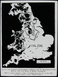
LS2654 Map of Roman Britain
7271
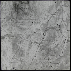
LS2655 Map of Roman Leicestershire
7294
LS2658 Map of Midlands, 410-871AD
7299
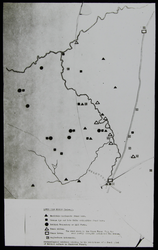
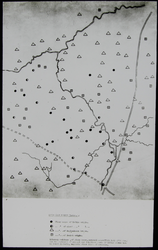
LS2660 Map of Archaeological Finds
7303
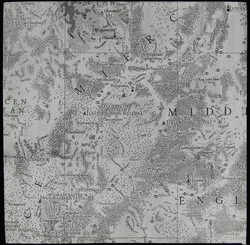
LS2661 Map of Place Names
7308
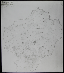
LS2662 Map of the Distribution of Buildings and Woods
7313
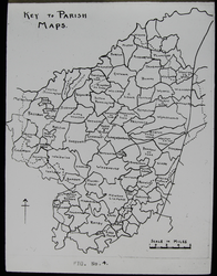
LS2663 Map of Parishes of the Lower Soar Region
7318
LS2664 Map of Manors, Domesday 1085-86
7350
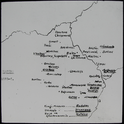
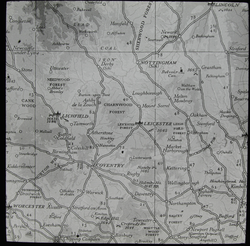
LS2670 Map of the East Midlands
7352
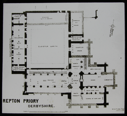
LS1484 - Repton Priory
7381
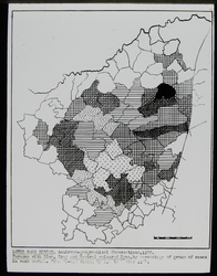
Map of Eye Colours in the Lower Soar Region
7399
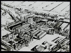
LS1494 - St Albans Abbey
7401
Map of Population Changes in the Lower Soar Region
7406
Map of Communications Equipment In The Lower Soar Region
7411
Map of Fair Hair Density in the Lower Soar Region
7413
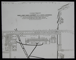
LS1497 - Christchurch Priory
7421
Map of People With "Long Heads" in the Lower Soar Region
7431
Map of Population in the Lower Soar Region
7744
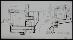
LS1561 - Watton Priory
7768
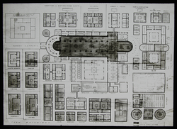
LS1566 - St Gall Monastery
1
2
3
4
5
6
7
8
9
10
13
Page 2 of 13